Google Earth
Description
Explore Google Earth from anywhere. Whether you’re on your computer, mobile phone, tablet or browsing the web — there is a version of Google Earth for you.
Desktop
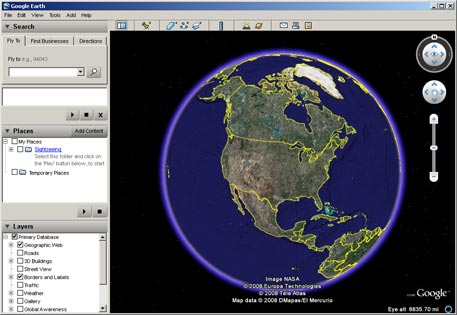
Google Earth 6 is available for the desktop in three different versions: Google Earth, Google Earth Pro, and Google Earth Enterprise. Fly anywhere to see satellite imagery, 3D buildings, 3D trees, terrain, Street View, planets and much more.
Web
Use the Google Earth plug-in to explore a 3D globe with Earth view in Google Maps and on sites across the web.
Mobile
Explore the globe from the palm of your hand. Download Google Earth for Android, iPhone, or iPad.
Pricing
| Plan | Price | Details |
|---|---|---|
| Google Earth | Free | Google Earth lets you fly anywhere to view satellite imagery, maps, terrain, 3D buildings, galaxies in outer space, and the depths of the ocean. |
| Google Earth Pro | $399 | Google Earth Pro includes the same easy-to-use features and imagery as the free version of Google Earth, but with additional professional tools designed specifically for business users. |
| Google Earth Enterprise | Varies | Google Earth Enterprise is intended for organizations that have large quantities of geospatial data and allows customers to build globes from their own imagery, aerial photography, and data. |
Reviews
Google Earth è un software gratuito che ci permette di visualizzare le immagini satellitari di tutto il mondo.
Nonostante alcune differenze nella risoluzione, non sempre omogenea, il programma è molto buono. Senza dubbio permette di soddisfare curiosità su luoghi mai visti, oppure ci consente di ricordare con grande realismo luoghi che si sono visitati, magari solo come turisti, per un breve periodo. In ogni caso gli usi di Goohle Earth sono vastissimi; qualcuno lo sfrutta per indagini archeologiche dall’alto, altri per studiare l’ambiente o imparare la geografia…
Questo software è stato concepito molto bene sul piano della navigabilità delle immagini ma presenta un punto debole: le immagini riprodotte non sono sempre aggiornate. La tutela della privacy non permette infatti di caricare foto scattate troppo di recente.
Molto utile anche il correttore lessicale, che permette di trovare i luoghi che non hanno una semplice grafia oppure se si sbaglia a digitarne il nome.
Google Earth is a great tool for personal use so that students can explore various parts of the Earth on an interactive map just for fun. Then, it can also be used in the classroom as a teaching tool, especially for History/Geography teachers. In English classrooms, teachers can think of creative ways to implement Google Earth to look for countries or places of origin where a novel takes place.
There are only advantages to using Google Earth in the classroom. I would highly recommend it.
I enjoy using Google Earth in the classroom. We live in a very remote location, so it is a handy tool for allowing students to see what the rest of the world looks like. We look up cities and towns that we read about in our social studies lessons. When a new student comes in, we pull up his former town to compare it with his new home. I have also used Google Earth to give students a better understanding of maps and roadways.
Students really enjoy understanding and seeing what they are learning. Use this tool briefly to show students where something happened in the news or in a fictional text (Of Mice and Men, Macbeth…). Places can be explored in more depth if you ask students to imagine they are there, use their senses and describe the setting.
The tool also highlights different cultures and religions. It may be worth asking students to tell you where their relatives live and exploring different cultures in this way. Different famous buildings, religious buildings and tourist destinations can also be seen.
Practically, if you have an interview, meeting, holiday or a new job then check the location on here. It shows you a street view that can really help you to find the place you are searching for when you travel.
Google Earth is a useful tool that allows us to locate addresses from anywhere around the world. I know one of my employers has used this tool once when verifying my school address and afterwards describing to me the landscape of my school. It was amazing how he describes my school with pinpoint accuracy. The zoom in/zoom out feature is very useful and has a pretty amazing view. This tool is not just useful for employers, but also for anyone who wants to verify different places. If you want to go on a vacation and want to see the surrounding view beforehand, use this free tool. As a teacher, I can use this tool to show my students different locations. I highly recommend this tool for anyone who wants to see places where they're going beforehand or to anyone who just wants to see different views.
I teach a unit on genealogy where the students have to trace their roots to certain locations. It is awesome how faces light up when they use Google Earth to actually locate specific sites, homes, areas and other visual things about their family location histories. It is super simple to use and can be converted into maps and downloaded and printed as well. The value is great since many levels of cognitive learning are utilized and can be adjusted to all types of learners.
Google Earth is an online tool that allows one to explore our Earth. It is an easy tool to use as users can zoom in and out on various locations around the world. This tool can be useful in classes such as Social Science, History, English Literature, and English as a Second Language.
I can use this tool to show my students various locations around the world in relation to themselves. For example, as a teacher in South Korea, my students are not usually familiar with Western countries. This tool makes it easy for them to explore various places that we read about or discuss in the classroom.
I would recommend this tool for those teaching any subject in which a student must learn about a new country or city.
Google Earth is a software tool used to explore the world. I usually used Google Earth in my social studies class and have discovered it is a very important teaching aid,my learners have been able to take a ride all over the world within a short time and discover physical features, geographical position of places and shape of the earth in real life situation for themselves. It has enable me to achieve my lesson objectives very easily and also learners retain what I teach in class as by the end of the lesson I usually ask questions and my the learners have been able to answer questions correctly, thanks to Google Earth. It creates a very interesting atmosphere in class.
Google Earth is a very important tool, it easy to operate I usually search on website zoom in dragging to place i want as my learners watch I explain what they need to know and it is really very interesting. It is a very important tool that every educator should for effective teaching.
Google Earth is one of those cross-curricullar tools that can be embedded into science, social studies, and even english classes. The students love the ability to zone in on various locations around the globe. I personally have used this software in socail studies classes. It is especially useful when discussing places that are on the other side of the globe and is able to maintain the students' attention moreso than just showing them a map or a video that also references locations.
Although this program is a bit difficult to use at first and does occasionally lock up computers (requiring re-starts), it is worth the effort!
Google Earth is a tool that could be used by a science teacher, history teacher, language arts teacher, or mathematics teacher. For instance, the science teacher might want to talk about a particular lake and the animals that inhabit the lake. The teacher could check Google Earth for pictures of the lake and use these as a hook to grab students' attention and get them engaged in the learning process.
In another example, a language arts teacher might want to develop students writing ability. The teacher could use a Google Earth source (visual) in conjunction with a verbal prompt to spark her students' creative juices. Here the teacher uses a visual and verbal strategy to facilitate student learning.
It isn't intuitively obvious how Google Earth would be valuable to a literature teacher – but it is. I recently developed resources for both The War of the Worlds and Treasure Island. As both are set in England, students are not familiar with the locations of different settings. Using Google Maps, I created resources to help students track the progress of characters and to help them better understand the distances between different settings. Great tool – and as more and more street views are becoming available it is only getting better.
I use this tool to identify the location of places around the world.It is convenient and highly useful and very accurate.What it does is to engage the students in a very stimulating and lively way.
Google Earth is a tool that can be used in many subjects from math to language arts. The user base is very large providing a wealth of lessons and ideas. In addition, it's free and cross-platform.
I am using Google Maps with my 9th grade English class. We are currently Reading Around the World in 80 Days by Jules Verne and we are tracking his travels by using place marks on our own personalized maps. We are also exploring each location and making a type of travel guide along the way. I do find some of the features challenging, and not all of the students had gmail accounts, but overall it is something I will try again next year.
I have used this tool in many ways most notably for teaching map skills, measuring geographical distance, and plotting locations.
It's strength is in its accuracy. It's weakness is its frequent overloading that can cause images to be blurry even from a panned out view.
Discussing the Palace of Versailles with your students. Why not take them there with Google earth. Virtual field trips, or topography study.